- 1. The Grid System & Mapping Tech
- 2. Record Keeping Methods
- 3. Modern GPS Technology
- 4. Real-World Example
- 5. Common Challanges
The Grid System & Mapping Tech
Cemeteries implement a highly advanced coordinate system to identify every burial plot with precision. It functions much like a giant chessboard where each square has a distinct address. Cemetery administrators use traditional surveying instruments such as theodolites and measuring tapes to set up main reference points, usually called benchmarks.
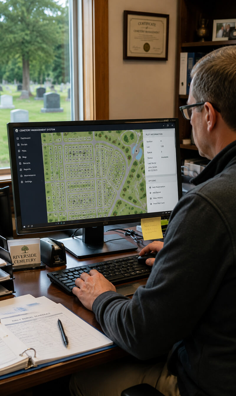
Each large area is further classified into blocks, lots, and separate graves. GIS mapping software has dramatically improved the process, allowing cemetery personnel to create digital layers that correspond to the real locations. The maps show the sections (like “Section 12A”), rows, and grave numbers that make up the three-part address system.
Record Keeping Methods
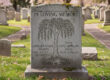
Well-kept records play the leading role in cemetery management. Indeed, each interment results in a number of documents being created and saved in ledgers as well as digital storage. The DBMS includes the following essential data: the name of the deceased, date of burial, plot coordinates, purchaser information, etc.
💡 Interesting Fact:
As per the figures of the International Cemetery, Cremation and Funeral Association (ICCFA). as many as 85% of cemeteries in the world have computerized record‑keeping systems in order to reduce mistakes and enhance accessibility.
Plot deeds function as legal documents, in a manner similar to property titles. These records connect the deceased person with exact coordinates, so that families will be able to get to their loved ones even after several years. Most facilities have multiple backup systems, including cloud-based archives as well as physical records.
 Modern GPS Technology
Today, cemeteries use survey‑grade GPS systems that can achieve accuracy within 10–15 centimeters. Handheld GPS devices enable the cemetery staff to find graves even if they are not marked or are difficult to locate. Using this technology has become extremely helpful in old cemeteries where the headstones have worn away or been displaced.
RTK GPS systems offer even higher accuracy because they use correction signals from base stations. In addition, ground-penetrating radar (GPR) is a helpful tool by detecting underground disturbances, thus allowing cemetery staff to confirm the locations of the burials without digging.
Real-World Example
📖 Case Study: Arlington National Cemetary
Arlington National Cemetery in Virginia covers more than 400,000 gravesites scattered over 639 acres. Its location system combines traditional grid mapping with modern technology. Every grave has a special 8-digit number which is directly connected to the GPS coordinates. If families come for a visit, the staff will be able to show them the way to the exact plots in a matter of minutes because they are using tablet devices equipped with specialized software.
After old records proved to be inconsistent, Arlington organized a major resurvey in 2013 using laser scanning and GPS to locate each burial precisely. The result was that hundreds of inaccuracies were fixed and this also led to the creation of a digital archive covering more than a century of paper records, ensuring that the resting place of no service member gets lost to history.
Common Challenges
Cemeteries continue to struggle with challenges even though their systems are highly developed. For instance, ground settlements may dislocate markers especially in the older parts. Also, tree roots, erosion, and alterations in landscaping are changing the ground slowly making fresh surveys necessary.
Human error is still an issue: numbers may be transposed in the records, old ledgers may have very bad handwriting, or markers may get misplaced during renovations and thus create difficult identification problems. Apart from that, vandalism and the stealing of metal markers complicates the search for locations.
Nowadays, a large number of cemeteries are burying permanent underground markers made of concrete or metal in close proximity to the surface headstones. Such a dual-marker system not only survives surface disturbances but also provides cemeteries with a permanent reference system. This, together with digital record redundancy, helps to keep burial locations traceable for upcoming generations.